

Milam Village & Johar Valley: The Ultimate 4×4 and Nanda Devi Trek Guide
It is June 20, and I am in Munsiyari, Uttarakhand—a gorgeous town famous for its cascading waterfalls and the majestic backdrop of the Panchachuli peaks.
This is my first time visiting the Kumaon region. Having traveled through Garhwal since childhood, I’ve witnessed its rapid development. While Garhwal remains beautiful, navigating popular spots today often means dealing with heavy crowds. That is exactly why Kumaon caught my attention. I decided to explore the Johar Valley, a place so stunning and pristine that anyone wanting to experience the true, raw roots of Uttarakhand absolutely must visit.
I traveled with two college friends, Gaurav Laspal and Tarun Rawat, whose own roots tie back to Milam village. We drove from Dehradun, picking them up in Haldwani, and set our course for Munsiyari, stopping overnight at Kasar Devi. The next evening, crossing Kalamuni Pass, I witnessed the Panchachuli peaks bathed in the golden light of the setting sun.
Here is everything you need to know to plan your own off-the-grid expedition to Milam Village and the Nanda Devi East Basecamp.
Quick Facts & Logistics
| Parameter | Details |
| Base Town | Munsiyari, Pithoragarh District, Uttarakhand |
| Highest Altitude | ~4,150 m (Nanda Devi East Basecamp) / ~3,300 m (Milam Village) |
| Key Distances |
Munsiyari to Lilam (~12 km)
Bugdiyar to Rilkot (~14 km)
|
| Trail / Road Status | Rough 4×4 track cut into trans-Himalayan rock. (Subject to monsoon closures) |
| Permits (Indians) | A valid Govt ID (voter ID, passport) is required at the ITBP Bogdiyar & Milam checkposts. |
| Permits (Foreigners) | Inner Line Permit (ILP) strictly required, obtainable via SDM office in Munsiyari |
| Connectivity | Zero mobile network and electricity beyond Munsiyari; strictly cash-only |
| Best Season | May to June (pre-monsoon) & September to October (autumn) |
Munsiyari to Milam 4×4 Road Status (2026 Update)
Munsiyari is the last major settlement and the gateway to the Johar Valley. We stayed for two days, exploring local waterfalls and finalizing our gear. Munsiyari is the final point where you get electricity and mobile networks; beyond this, you are completely off the grid for 4 to 5 days.
Since we were carrying tents, sleeping bags, and cooking utensils, we shopped for all remaining rations here. On our second night, we parked my car at a trusted hotel and booked a local 4×4 taxi.
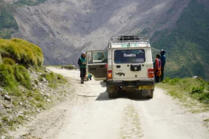
Johar Valley sits in the trans-Himalayan range, sharing borders with Tibet. Road construction began post-COVID, and now in 2026, a route has finally been cut. It is a hardcore off-road trail—an absolute paradise for 4×4 riders, but impassable for standard cars. The freshly blasted rock-cut sections, particularly the notoriously narrow stretches near Laspa and Bugdiyar, require high clearance and extreme driving precision.
[Embed your multi-part Johar Valley YouTube vlog here to showcase the route maps and 4×4 terrain.]
The Journey: Talla to Malla Johar
Johar Valley is divided into Talla (Lower) Johar and Malla (Upper) Johar. This valley is home to the Bhotia (Shauka) community, who historically migrated between these high-altitude summer villages and lower towns during winter.
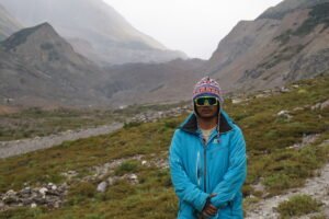
The ride into the valley was the greatest Himalayan journey of my life. After the first 20 kilometers, we climbed onto the roof of the taxi. Following the Gori Ganga river, the narrow valley eventually opens up to reveal breathtaking views of Rajaramba, Nanda Devi, Bankatiya, and Trisuli. Entering the upper limits requires passing two ITBP checkposts—at Bogdiyar and Milam—where IDs and permits are strictly verified.
Milam Village: History and the Glacier Zero Point
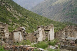
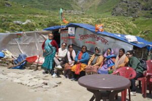
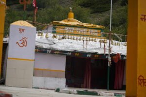
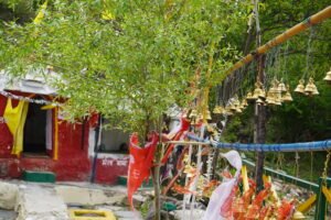
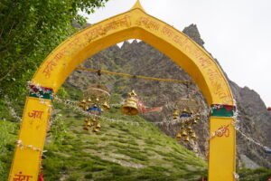
When Milam finally came into view at 3,300 meters, I was genuinely shocked to see massive green fields, active farming, and kids playing. Before the 1962 Indo-China war, over 500 families lived here, running a thriving trade route with Tibet. Today, only 40 to 50 families return in the summer to farm or forage for Keeda Jadi (Himalayan Gold).
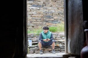
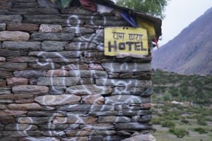
We stayed at a friend’s ancestral home, enjoying dried mutton and traditional Zaa (butter tea), which is incredibly effective at keeping your body warm at high altitudes. We also trekked to the zero point of the Milam Glacier—the second largest in Uttarakhand after Gaumukh. Seeing a village abandoned by historical conflict broke my heart, yet the traditional stone and mud houses with their distinct wooden Chaukats (gates) felt comforting and deeply rooted in Himalayan heritage.
Ganghar to Nanda Devi East Basecamp
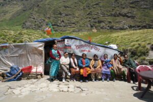
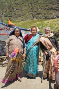
The next morning, we found a taxi back to Burfu and immediately transferred to another vehicle to Ganghar, the base village for the Nanda Devi East trek. We arrived around 10 AM, where a local Ama (grandmother) cooked us massive plates of khichdi. Only a handful of families currently live in Ganghar.
Loaded with 15 kg backpacks, we began our 8 km trek to the basecamp at 1:00 PM. We arrived by 4:30 PM, greeted by shepherd dogs and a direct, awe-inspiring view of Mount Nanda Devi. The shepherds invited us in for tea as heavy rain set in. We pitched our tents and slept through a relentless downpour.
If you are planning to experience this awe-inspiring 7,000+ meter peak up close, check out my comprehensive Nanda Devi East Basecamp Trek itinerary to prepare for the altitude, trail conditions, and necessary gear.
A Golden Morning and the Journey Home
The shepherds’ prediction held true. By morning, the skies cleared, and for the first time in my life, I stood face-to-face with the holy Mount Nanda Devi and its twin peak, Mount Sunanda Devi. Witnessing the sunrise illuminate the 7,434-meter peaks left me absolutely hypnotized.
We trekked back to Ganghar by 2:00 PM and eventually walked to Burfu and Laspa village for the night. We were rewarded with a stunning golden-hour view of the Bankatiya peak. Though the arriving monsoon forced us to cancel our Bankatiya basecamp plans and return to Munsiyari, witnessing the raw, unfiltered beauty of the Johar Valley is something I will never forget.
People Also Ask (FAQ)
Can standard cars drive to Milam village?
No. The route past Munsiyari is a freshly cut, hardcore rocky track suitable only for high-clearance 4×4 vehicles. Standard sedans or hatchbacks cannot navigate the trans-Himalayan terrain.
Where do you register for the Milam and Nanda Devi trek?
Indian nationals must present valid government identification at the ITBP (Indo-Tibetan Border Police) checkposts at Bogdiyar and Milam. Foreign nationals must obtain an Inner Line Permit (ILP) from the SDM office in Munsiyari prior to entering the valley.
Is food and accommodation available in Milam and Ganghar?
Basic homestays and seasonal local meals are available during the summer months when Bhotia families migrate up to the valley. However, it is highly recommended to carry backup rations, a sleeping bag, and a tent.
Will my phone work in Johar Valley?
No. Munsiyari is the last point for electricity and mobile network coverage. The entire Johar Valley is off the grid, and all transactions are strictly cash-only.
If you enjoyed reading about my journey and want to experience this pristine valley for yourself, the team at TrekTheThrills can help put together the perfect travel package for your adventure. Follow my page or send me a message—I would love to help you plan the ultimate Himalayan off-roading and trekking expedition!
– Anup Singh, Trek Leader & Founder, TrekTheThrills